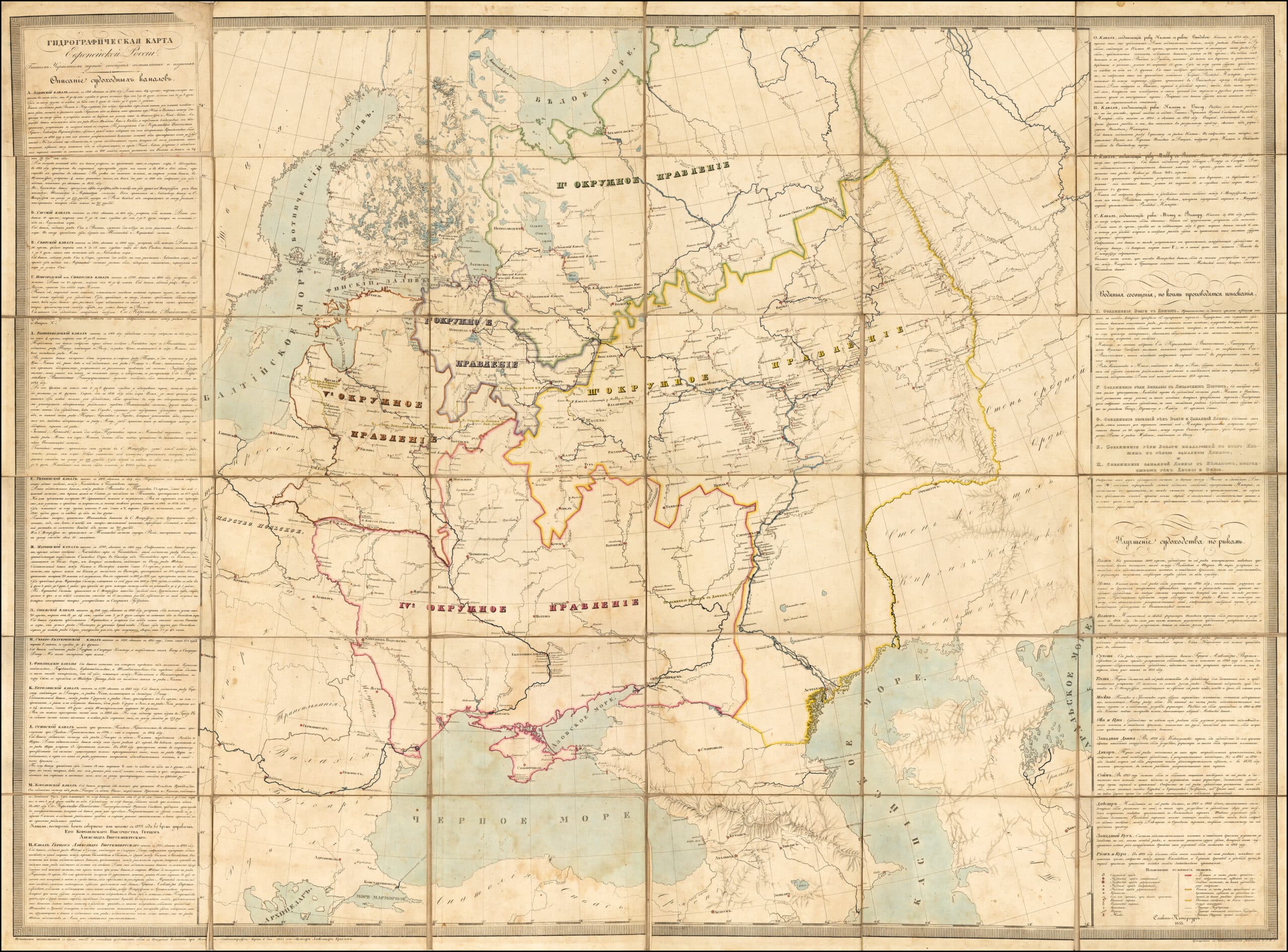
ГИДРОГРАФИЧЕСКАЯ КАРТА
ЕВРОПЕЙСКОЙ РОССИИ" (Hydrographic Map of European Russia)
государственный университет путей сообщения – ГУПС (State Transport University). St. Petersburg, in a folding hydrographic map depicting Imperial Russia’s extensive canal network. Also a higher-definition detail map of administrative department “V” – roughly the same boundaries as the former Grand Duchy of Lithuania. Descriptive side panels list canals and transportation on large rivers. Long-term goal: links between the Caspian, Black, Baltic, and White Seas.