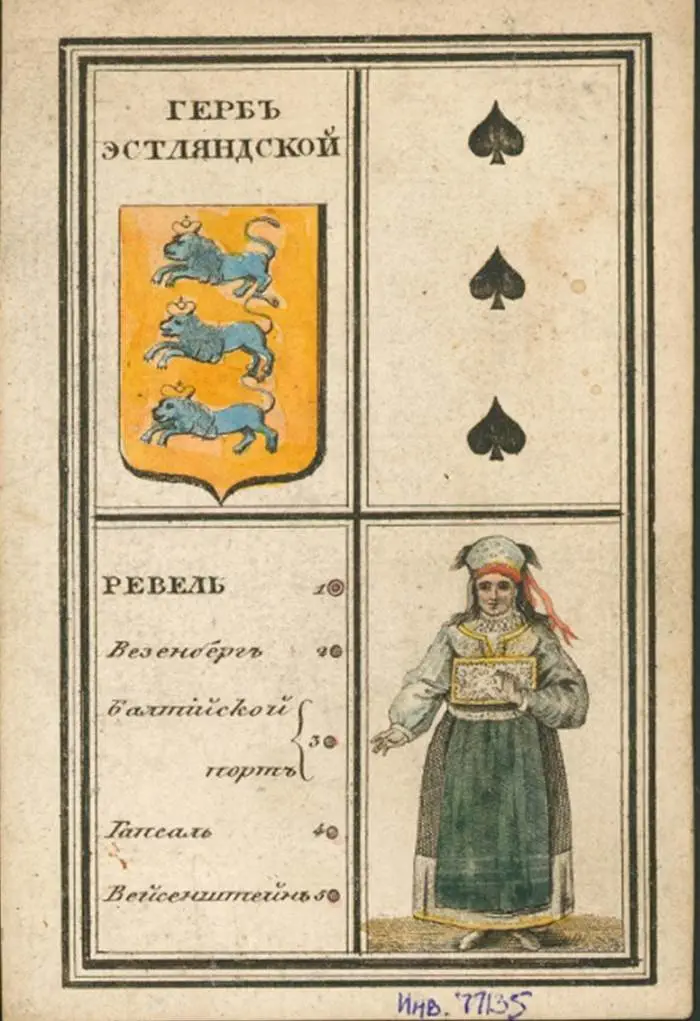
One side of each card shows the local costume, the provincial coat of arms and a list of numbered town names; the other side contains a map with numbers for the town locations, and the distance from the main town to Moscow in “versts” (1.0668 kilometers).