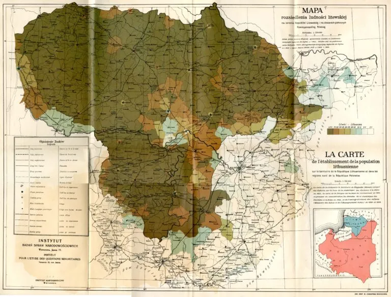
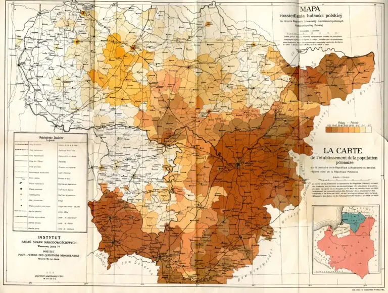
description
Mapa rozsiedlenia ludności Litewskiej na terenie Republiki Litewskiej and Mapa rozsiedlenia ludności polskiej na terenie Republiki Litewskiej i na obszarach północnych Rzeczypospolitej Polskiej nazwa współczesna
The first: Map of distribution of Lithuanian population in the area of the Republic of Lithuania. The second: Map of distribution of Polish population in the area of the Republic of Lithuania and in northern areas of the Republic of Poland. Warszawa, at 1:750 000. I looked at the statistics on both maps for my ancestral town: Žiežmariai (“Žyžmory” on the map). Poles are said to comprise 10% – 20% of the population; Lithuanians 50% – 75%. So, according to these Polish-produced maps, Lithuanians and Poles supposedly accounted for 60% – 95% of the population. Reality check: the 1923 Lithuanian census – the only census in Inter-war Lithuania – counted 2,198 residents, of whom 1,205 (55%) were Jews: a not uncommon percentage for towns in those days. Ethnicity was determined by primary language spoken – following the precedent of the 1897 Russian census. The Lithuanian census determined that the population was 84% Lithuanian-speakers, 7.6% Yiddish-speakers, 3.2% Polish-speakers, 2.5% Russian/ Belarussian-speakers, and 0.7% Latvian-speakers. The
Polish Election Committee disputed those findings, saying Poles comprised 10% of the population and Lithuanians 76.4%. The basis for their claim was the 202,000 votes (representing about 9.5%-10% of population) cast for Polish political candidates in the 1923 Lithuanian elections. All-in-all, pretty weak justification on both sides for territorial boundary and political decisions made on the basis of “ethnicity.”


