description
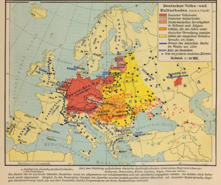
Deutscher Volks- und Kulturboden
Friedrich Wilhelm Putzger (teacher/ cartographer) – Velhagen & Klasing (publisher).
(German Ethnic and Cultural Lands), Bielefeld, from “F.W. Putzgers historischer Schul-atlas,” published from 1877 – 1979: 102 editions! Each black dot represents a “large German colony,” without defining
“large.” “Litauen,” colored yellow (“Area of German speakers in the east”), contains 6 dots, as well as the number 35,000: defined as the number of Germans. The map gives credit to geographer Albrecht Prenck, whose 1925 concept of Volks- und Kulturboden is considered as having ushered in German geography a völkisch (ethno-nationalistic) turn. Thus, critics say, he paved the way for Nazi
“Lebensraum” policies and became an accomplice in the resulting crimes.


