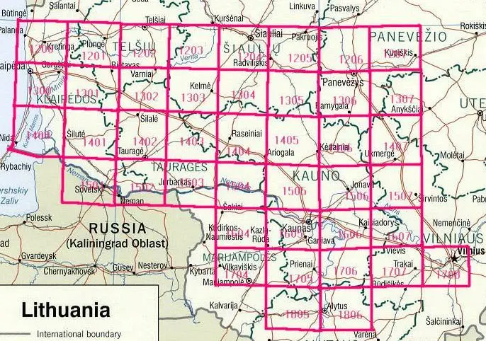
ŽEMĖLAPIŲ SUSKALDYMO LAPE [Index Sheet], Geltonos spalvos trapecijos : mastelio 1:100 000 lapas [Yellow trapezoids: scale 1: 100,000 sheet].”
From 1924 -1938 Lithuania’s Department of Military topography surveyed Lithuanian territory. Maps at 1:100 000 were compiled for about 2/3 of the country along with 92 sheets at 1:25 000 covering about 1/6 of the country.