description
Gilles Robert de Vaugondy and his son Didier Robert de Vaugondy
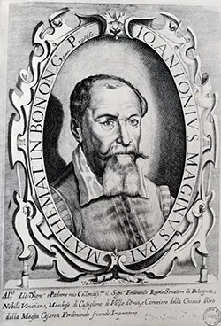
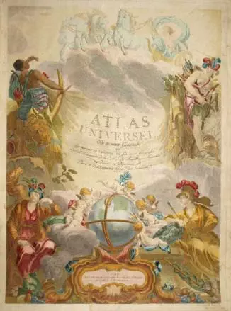
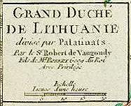
Gilles Robert de Vaugondy (1688–1766), also known as Le Sieur or Monsieur Robert, and his son, Didier Robert de Vaugondy (c. 1723–1786), were leading mapmakers in France during the 18th century. In 1757, they published “The Atlas Universel” one of the most important atlases of the 18th century. To
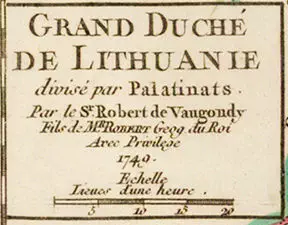
produce the atlas, the Robert de Vaugondys integrated older sources with more modern surveyed maps. They verified and corrected the latitude and longitude of many regional maps in the atlas with astronomical observations. The older material was revised with the addition of many new place names. Gilles was appointed “Geographe du roi” in 1734, while Didier was appointed geographer to Louis XV in 1751. Gilles and Didier produced their 500+ maps and terrestrial globes working together as father and son. In some cases it is uncertain whether Gilles or Didier made a given map. Gilles often signed maps as “M. Robert”, while Didier commonly signed his maps as “Robert de Vaugondy” or added “fils” or “filio” after his name. The Robert de Vaugondys were descended from the Nicolas Sanson family through Sanson’s grandson, Pierre Moulard-Sanson; from him they inherited much of Sanson’s cartographic material, which they combined with maps and plates acquired after Hubert Jaillot’s death in 1712 to form the basis for the “Atlas Universel”. Like Ortelius and Mercator, the Robert de Vaugondys’ credited their sources, which has greatly benefited the study of the history of cartography during that period. Their business was first taken over by globe-maker Jean Fortin, in 1778, and then by Charles Francis Delamarche. Their map “POLOGNE” dated 1750, was published in “Méthode abrégée et facile pour apprendre la géographie” a French geographical school book for
children, first published in 1705 by Abbé Le François. He wrote the book for his pupil Marie Anne Crozat, daughter of Antoine Crozat Marquis de Chatel, a French banker. In the dedication to “Mademoiselle Crozat” signed with the initials A. L. F., the author said that although his pupil, Miss Crozat, was herself already too accomplished to really need the book, he was sure that she would love to see her name mentioned. The book became very popular and became known as “Géographie de Crozat”. It was used in French education for almost a century, going through many editions from about 1751 until well into the 1800’s. The editions in the 1700’s all used Vaugondy maps, often dated 1750, but issued into the 1780’s. Later 18th century editions had new maps engraved but followed the Robert de Vaugondy outdated geography.
Dates
1688–1766 and 1723–1786
Place of birth
Paris