description
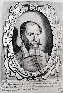
Strubicz (Strobicz), Maciej
“Prince Michał Radziwiłł “the Orphan”, son of Mikołaj “the Black” was voivode of Troki and Vilnius. Around 1585, he began co-ordination of the work on a Grand Map of the Duchy of Lithuania… Among others, he hired the King Stefan Batory’s cartographer Maciej Strubicz the Silesian, or “Slązak”. Earlier, Strubicz began work on editing and re-working maps of the territories subject to the King of Poland, particularly the map of Lithuania. A Mercator map, the best available presentation of Lithuania and Livonia at that time, was not satisfactory. The amount and quality of the data on that part of the Kingdom required devotion to the work on that map exclusively, which was Strubicz’s intention. Correspondence between Strubicz and Chancellor Jan Zamoyski, in which the cartographer asks Zamoyski for support in obtaining from the King materials relating to the Duchy of Lithuania, proves that the work on the maps was well advanced in 1579: “I am positive that there exists a more reliable and precise description of those Lithuanian Lands, made in the times of war, without which I started my work, but am not able to complete it, I would be much obliged to Your Excellency for Your
support to my earlier pledge to His Majesty the King, to lend me for a short time such description of the Grand Duchy of Lithuania”.
Strubicz’s own descriptions of Lithuania did not meet his requirements as materials for the new map. Such was probably also the case with the map for which he was asking, as in all likelihood it was the work by Stanisław Pachłowiecki, engraved in Rome, and made on the basis of data and materials collected during the Polock military campaign. Although being the first example of military cartography in Poland, the map did not meet Strubicz’s expectations. Therefore, the cartographer finally decided to work in co-operation with Mikołaj Krzysztof Radziwiłł, hoping that the latter’s energy and spirit of enterprise may lead to the publication of a highly accurate map of the Grand Duchy of Lithuania, as planned. As the starting point for research, Strubicz began collecting his own earlier works which he has been drawing since his appointment to the Royal Chancellery in 1559. Diligent and precise as he was, Strubicz probably was not the sole author of the map; it must have been a result of team work… Judging by surprisingly precise location of places where Jesuit colleges were, it seems that members of that order were involved in the work. Radziwiłł maintained close relations with the Society of Jesus, and even built a college for Jesuits in his hometown Nies’wież. The sciences were held in great esteem among members of that order, so in all probability, many measurements were made with state-of-the-art instruments and based on mathematical and astronomical calculations. It is known that the outstanding Jesuit mathematician, Englishman Jacob Bosgrave, was visiting Lithuania at the time when the map was created; some sources say that he was the founder of the mathematical department of Vilnius Academy. It seems therefore probable that Bosgrave contributed to the work of the editorial team, which was perhaps headed by the Prince himself. Bosgrave could have commissioned some work with his students at the mathematical department, as he was very complimentary about them in his letters to General of the order Claudius Aquaviva.
An analysis of Radziwiłł’s correspondence allows the assumption that the Prince sought assistance in the work on the map with Lithuanian, Belorussian and perhaps even Ukrainian magnates, and also with personalities at the Court. This clever strategy allowed the enterprising Prince to make use of various influences and support to execute his ambitious task in minute detail. One of such mighty assistants could have been voivode of Kiev, prince Konstanty Wasyl Ostrogski, to whom Radziwiłł wrote in order to collect data on the lower course of the Dnieper”.
Dates
1530–1604
Place of birth
Silesia