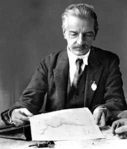
Student of German geographer Albrecht Penck, and became his greatest rival; chair of geography in Lwów starting in 1911; wrote and created maps for his 1916 “Geograficzno–statystyczny atlas Polski.” The 65 maps and 5 diagrams were created by him and his collaborators: W. Semkowicz, J. Nowak, W. Szafer, S. Weigner, J. Rutkowski, K. Nitsch, and B. Chodkiewicz. It includes maps showing physiograpy, administrative division, history of the Polish territory, population, nationality, religion, agriculture, industry and transport. The atlas was smuggled to the West and used by President Wilson’s Inquiry group, and at Paris in 1919. He mapped the east at Riga in 1921, founded a Cartographical Institute in the 1920s for political, geographic, geological and ethnic maps of Poland and Lithuania. Died Kraków. Commentary sourced from Steven Seegel’s 2018 “Map Men”