description
Jaillot, Alexis Hubert
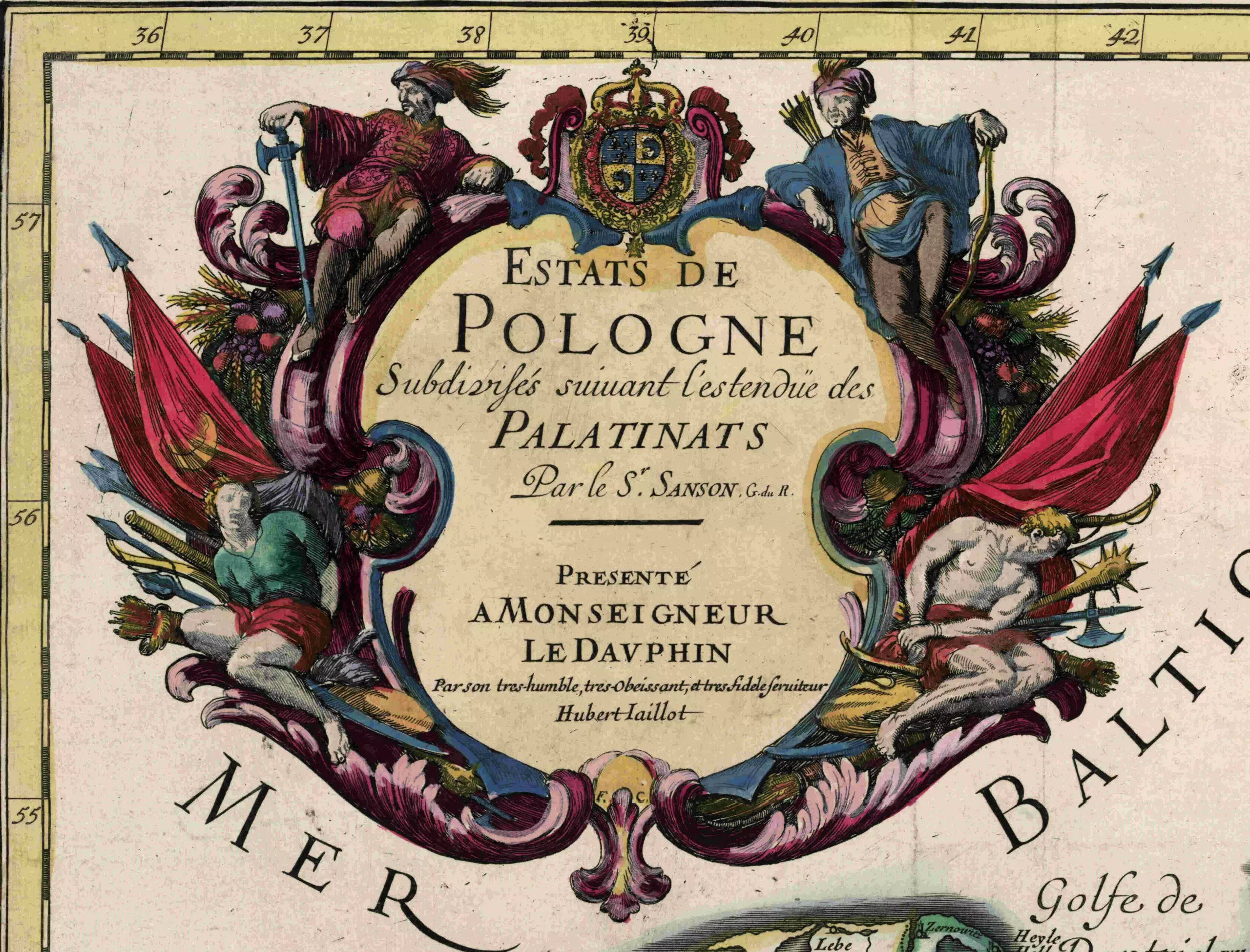
Alexis Hubert was a trained sculptor who, as a result of a father-in-law’s business, also became a print-seller and map-seller, publisher and geographer. In 1670 he asked Nicolas and Guillaume Sanson to rework the elder Sanson’s maps into two-sheet maps for a planned “Atlas Nouveau” in editions of 1681, 1684 and 1689. Jaillot’s atlas maps would become the largest format Atlas maps to be published in a commercial atlas in the 17th Century. Shortly after the initial publication, the maps would be copied by a number of mapmakers, including Pierre Mortier in editions of 1692, 1696 and 1698 in Amsterdam. Later, in 1721, Pierre’s son Cornelis joined with Johannes Covens I to form Covens & Mortier in Amsterdam. Also copying Jaillot’s maps were William Berry in London and Johann Hoffman in Nuremberg. Both the Jaillot Atlas and the Mortier Atlas would become commercially successful and would become the forerunners to the works of other publishers, most notably Herman Moll and the Price-Senex atlases of the first part of the 18th Century, but none of these other ventures would achieve a similar level of success and widespread distribution. Anotable Jaillot maps was titled “Estats de Pologne Subdivises suivant l’estendue des Palatinats Par Le Sr. Sanson…”
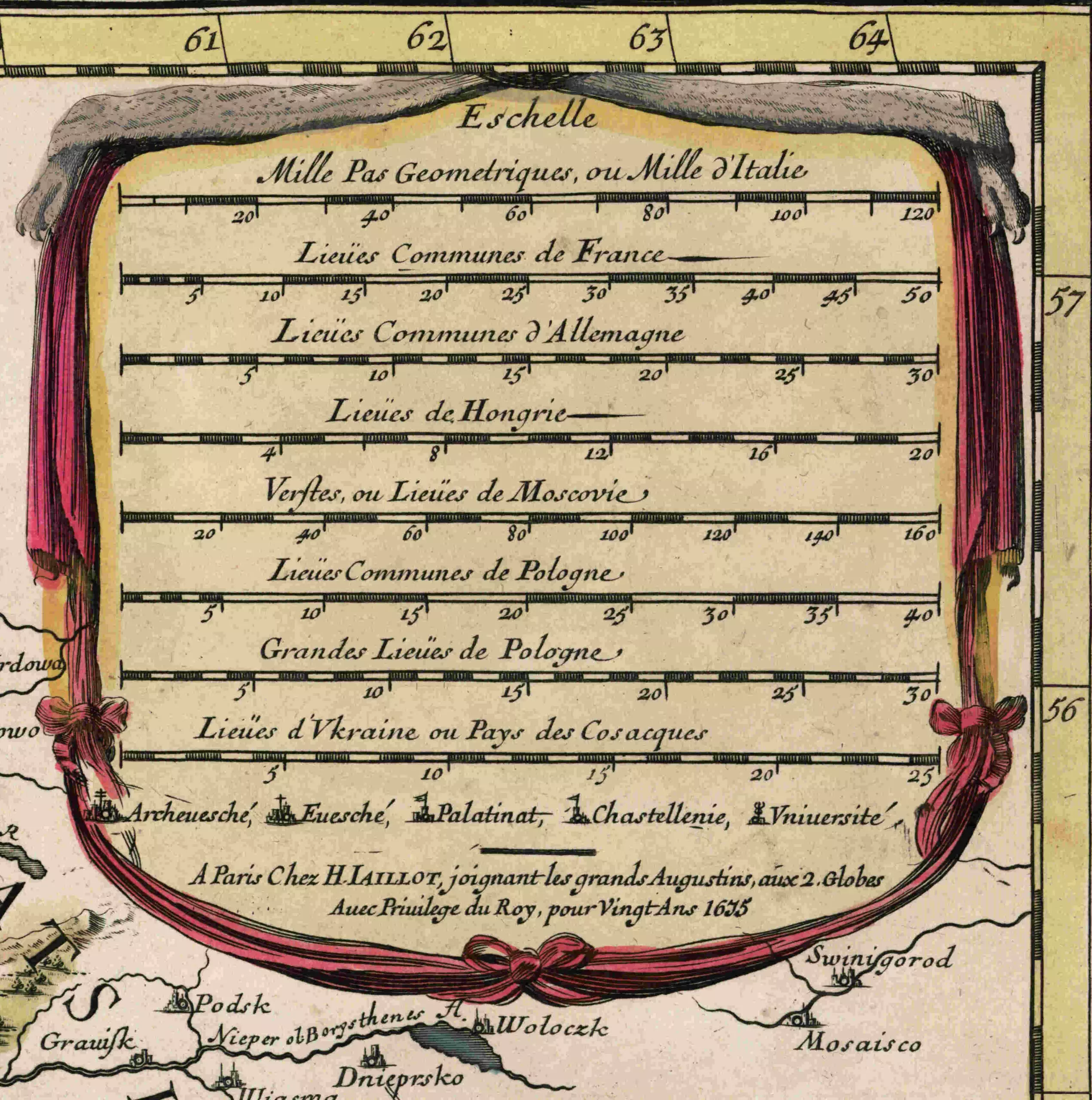
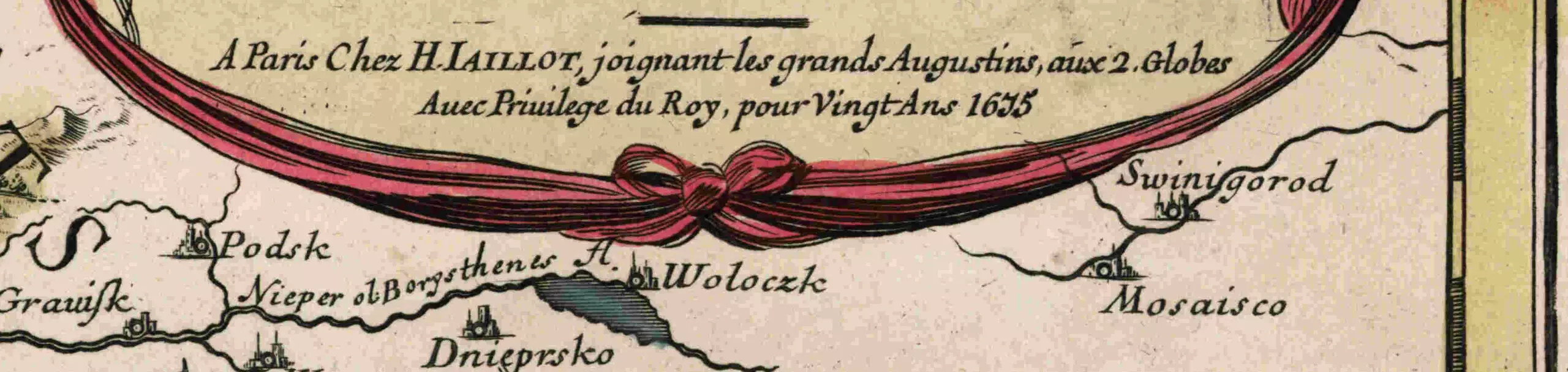
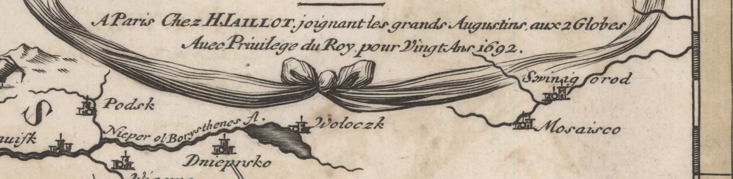
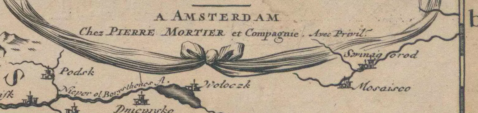
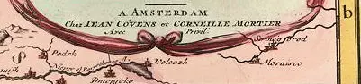
Here’s a guide to dating the various versions, all of which had the same two cartouches: (The differentiated text is at the bottom of the second cartouche.)
Dates
1632–1712
Place of birth
Saint-Claude