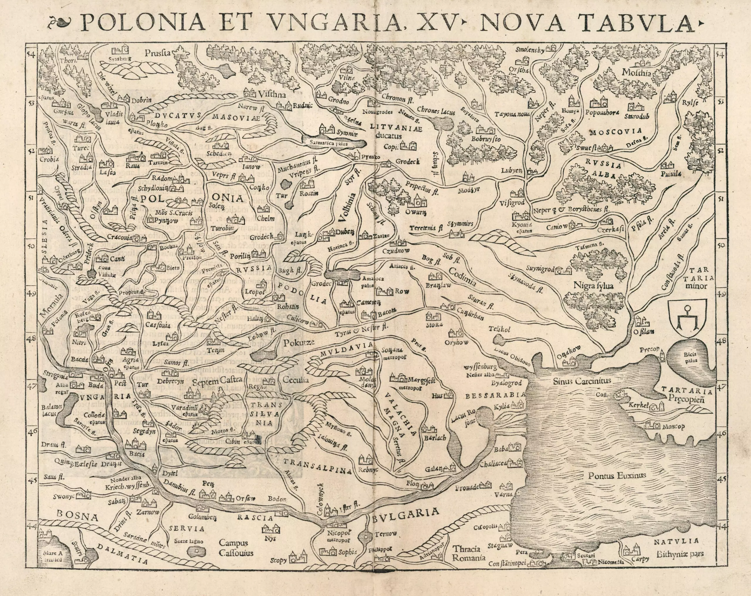
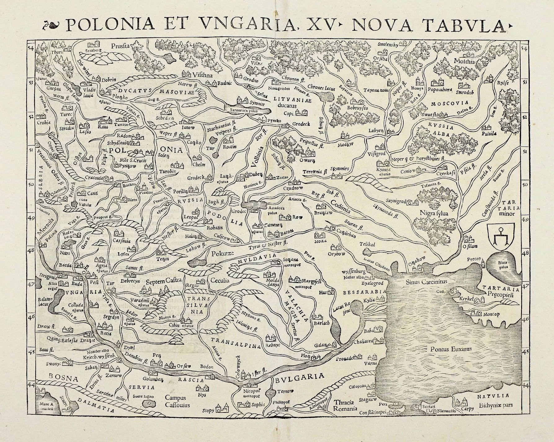
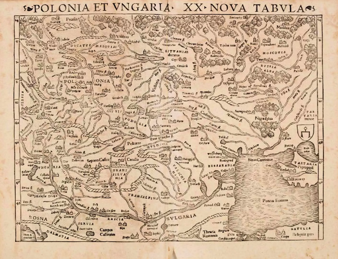
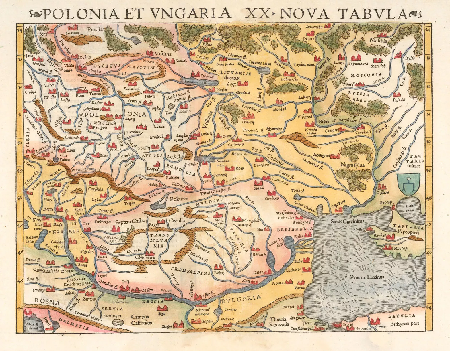
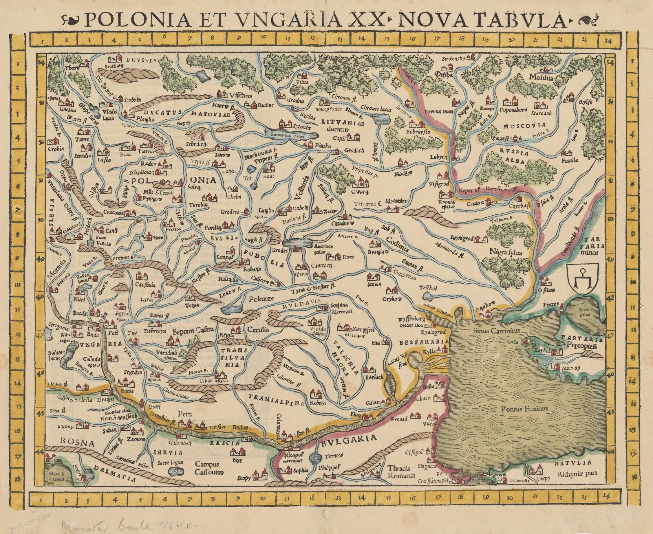
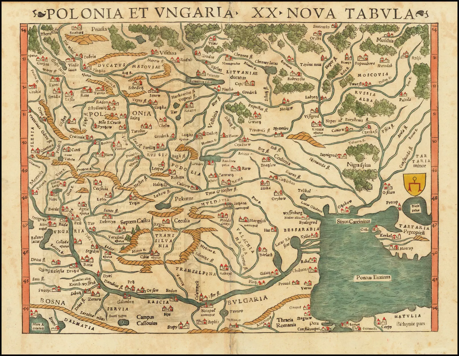
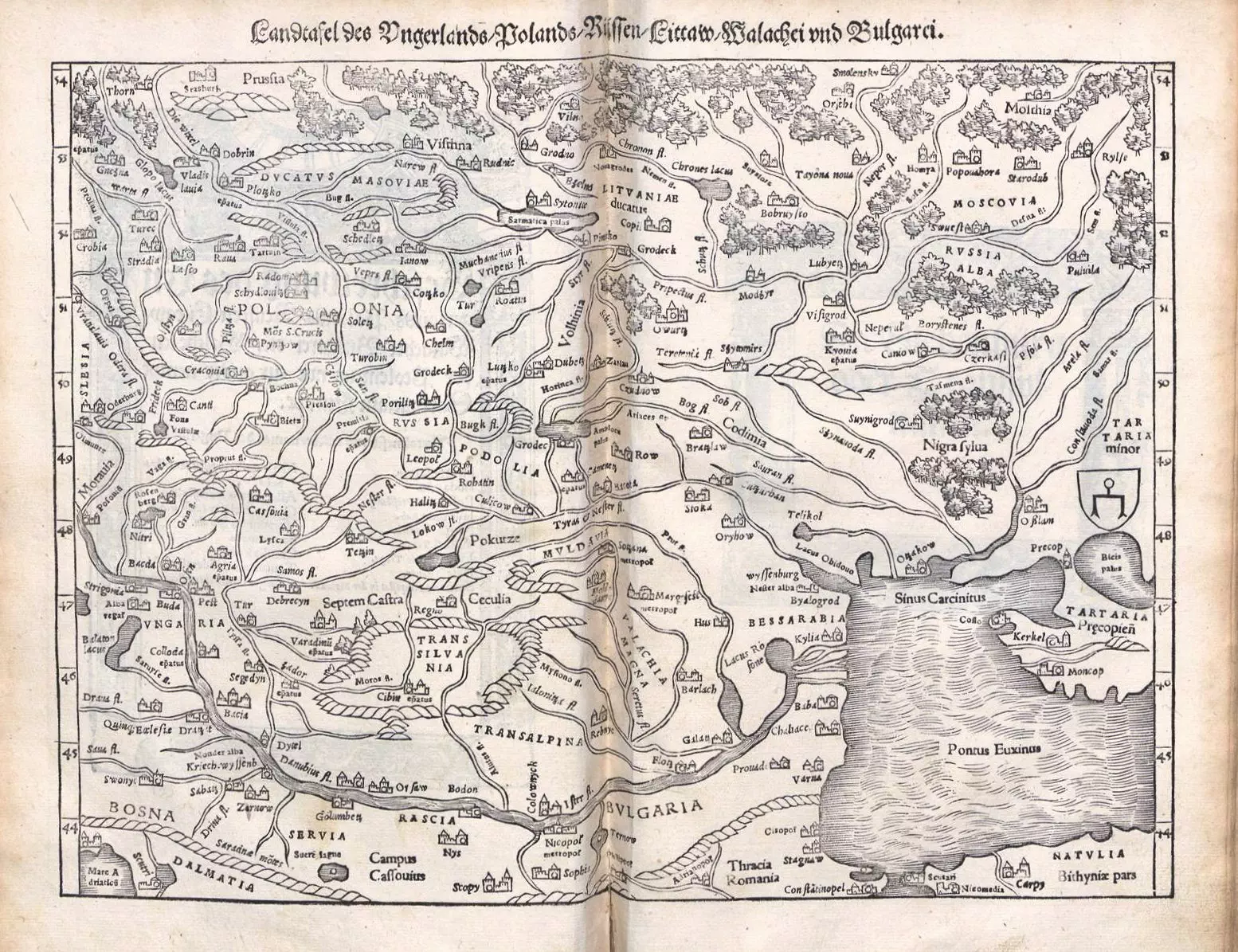
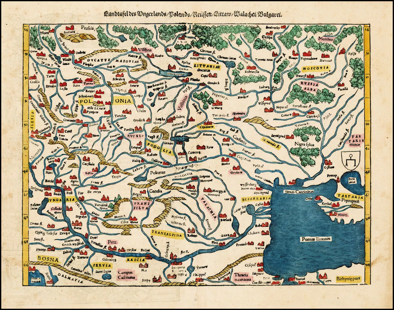
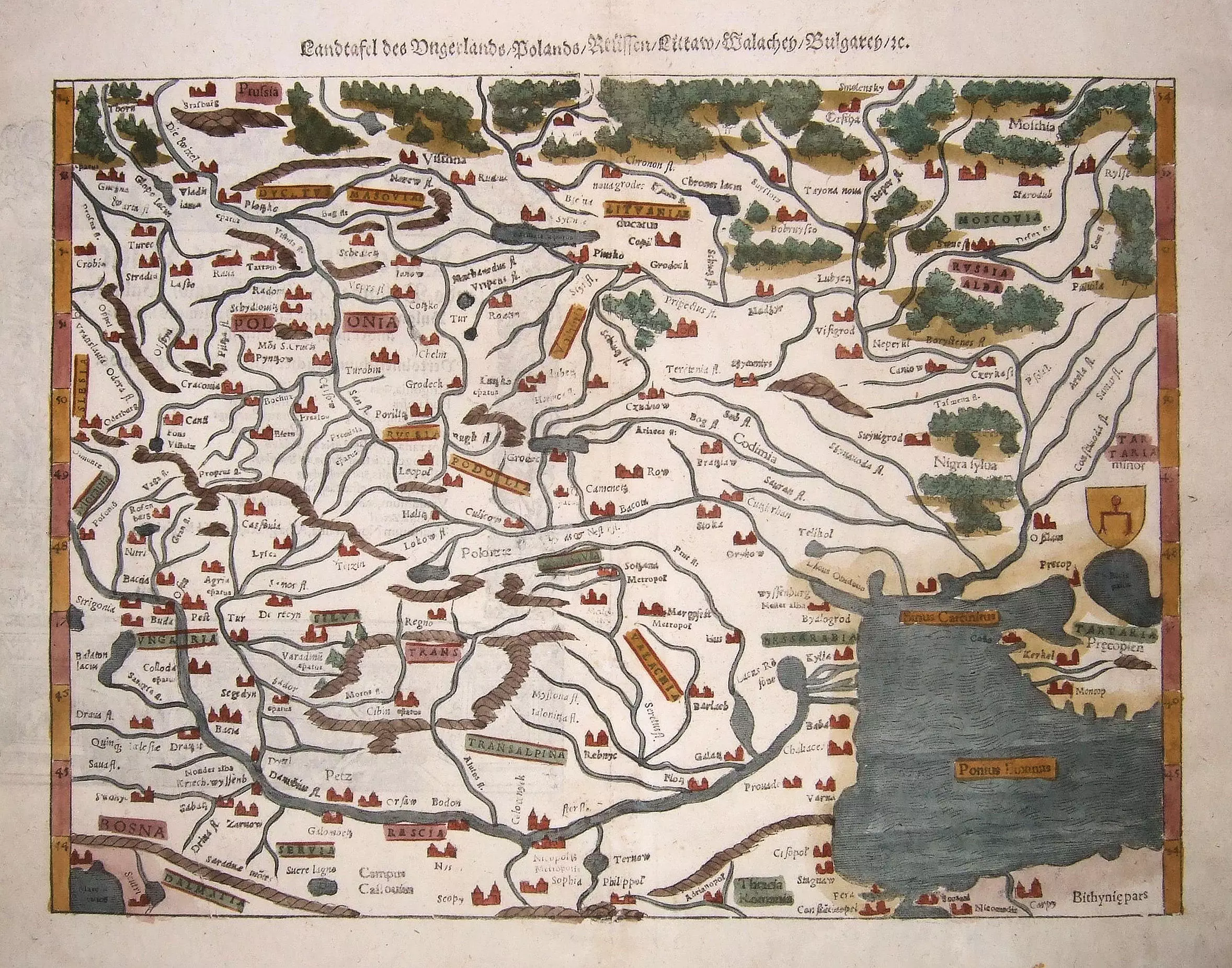
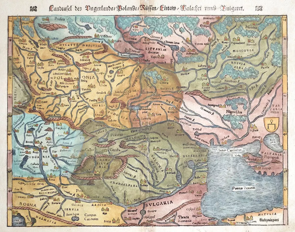
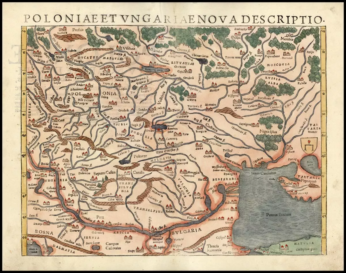
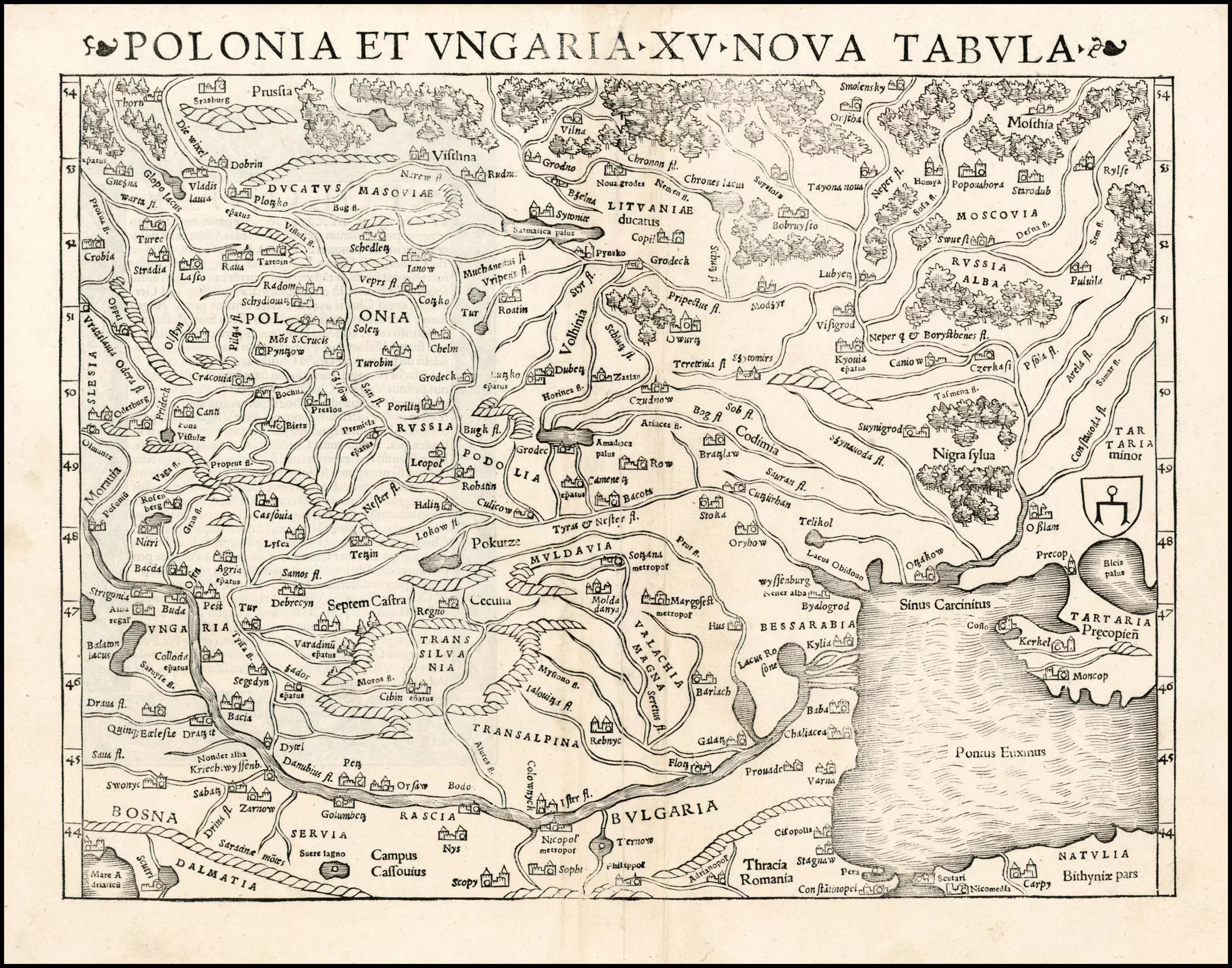
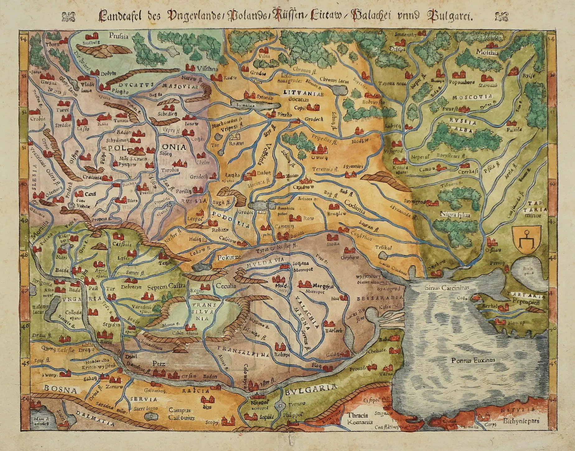
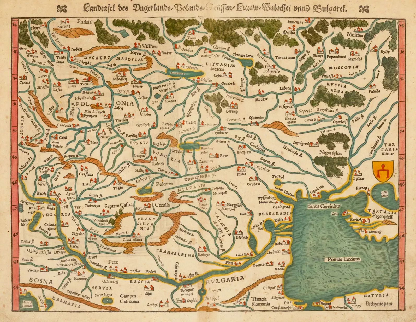
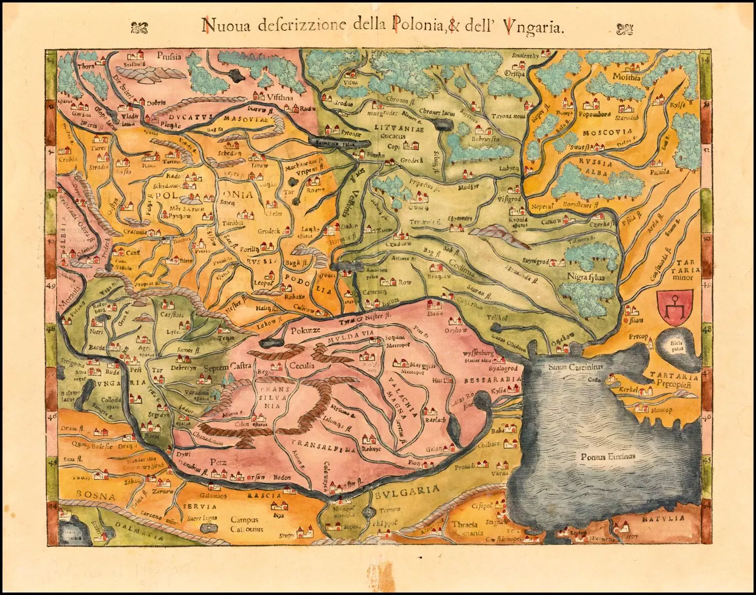
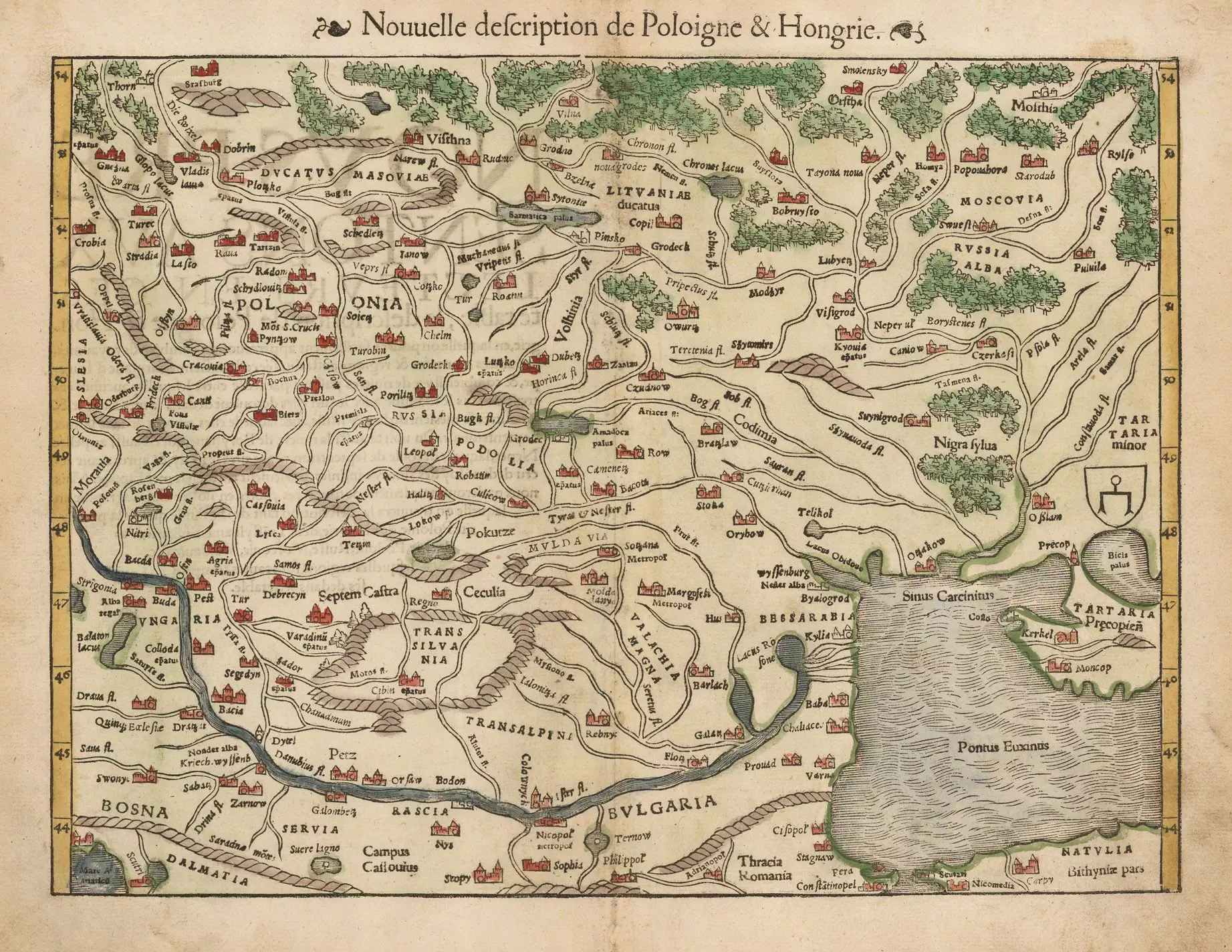
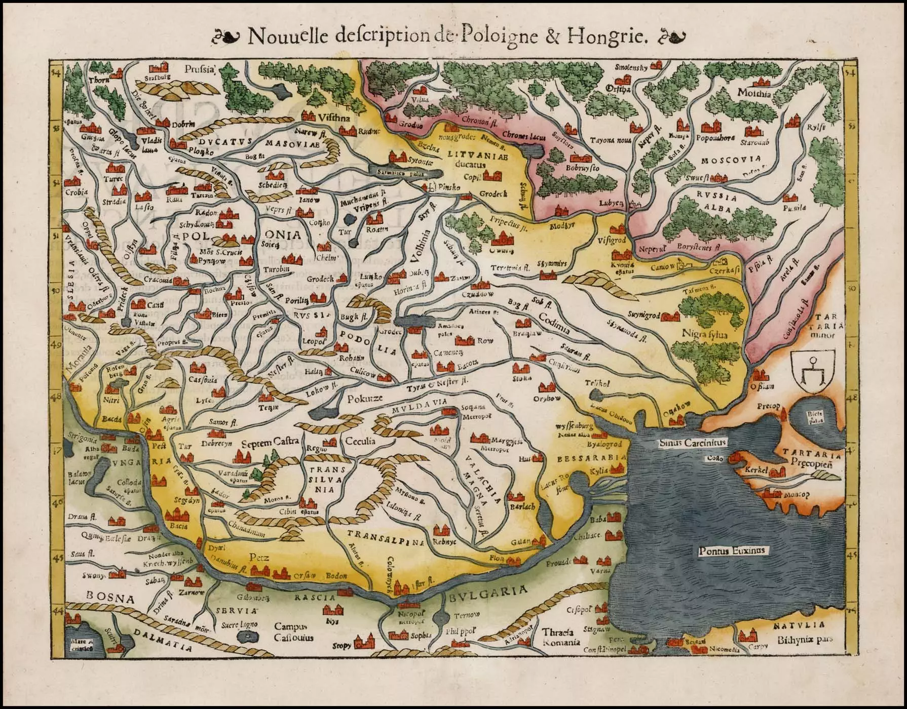
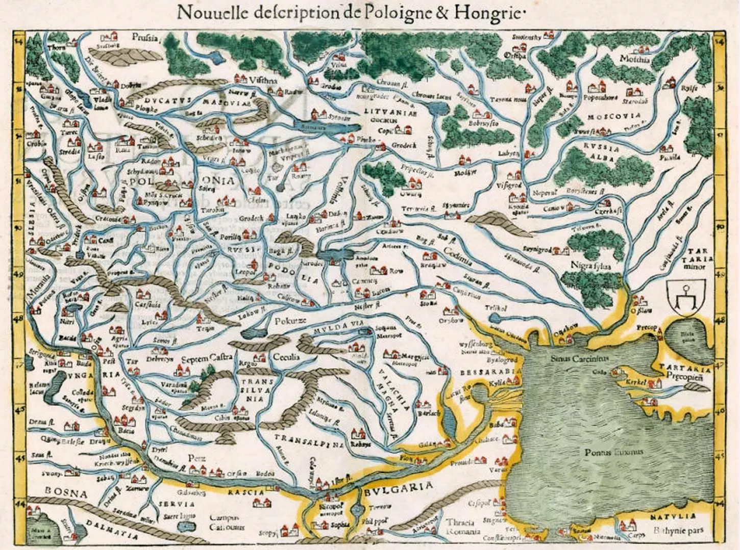
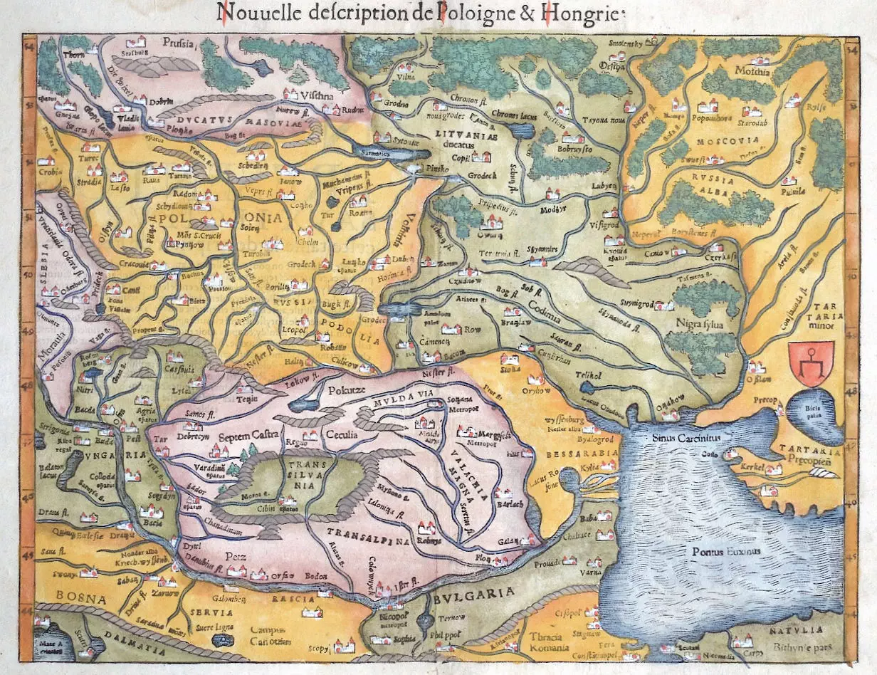
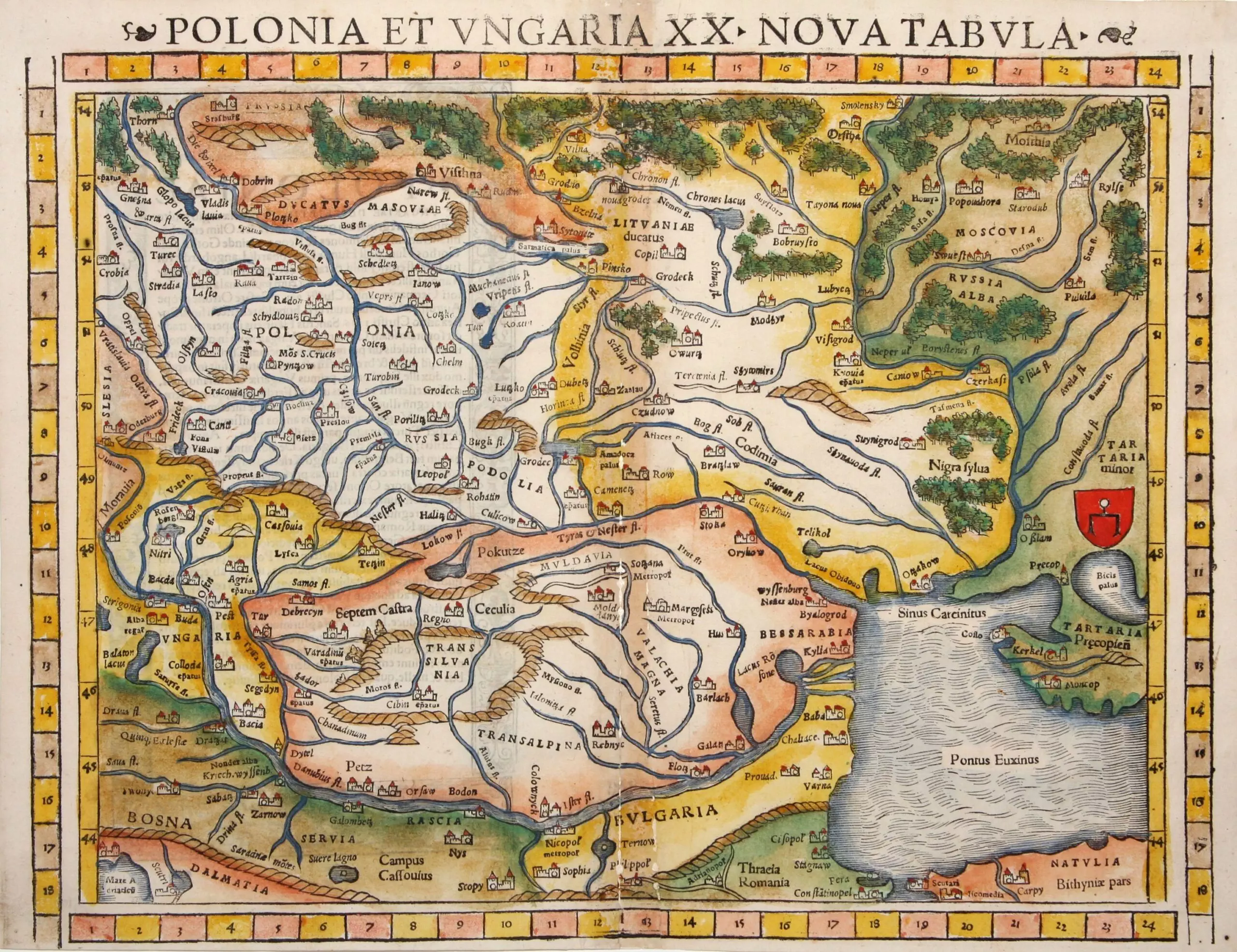
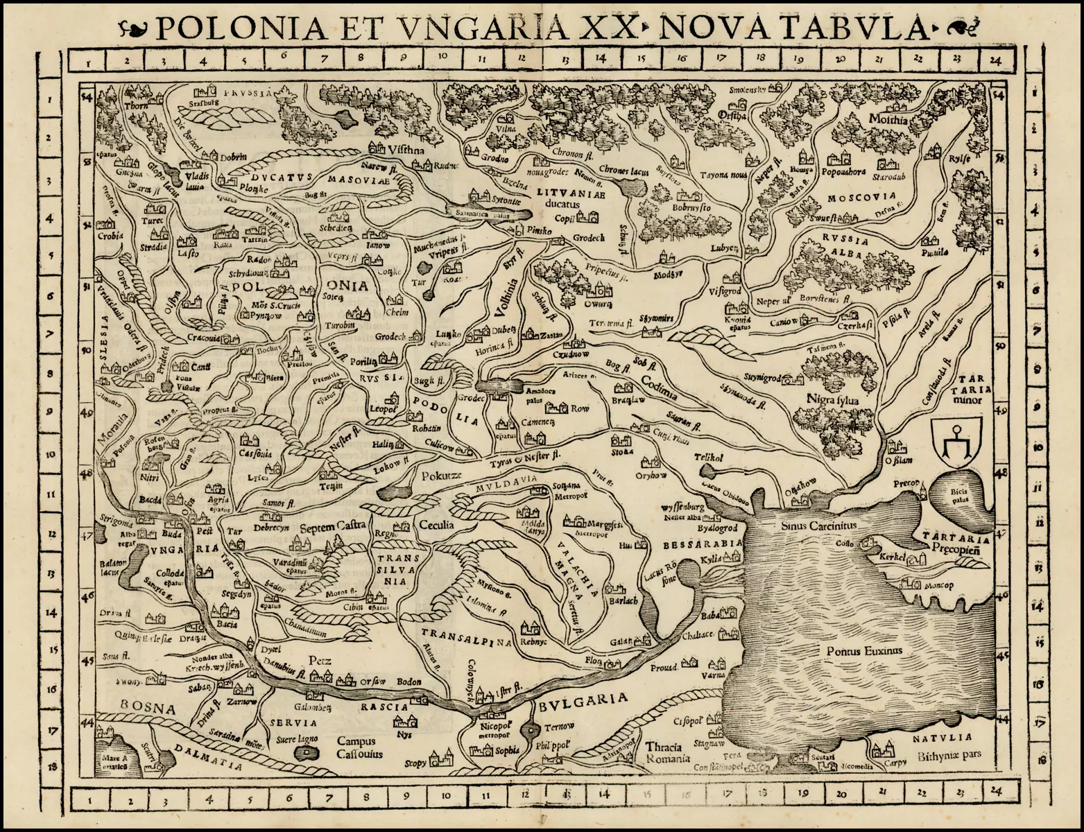
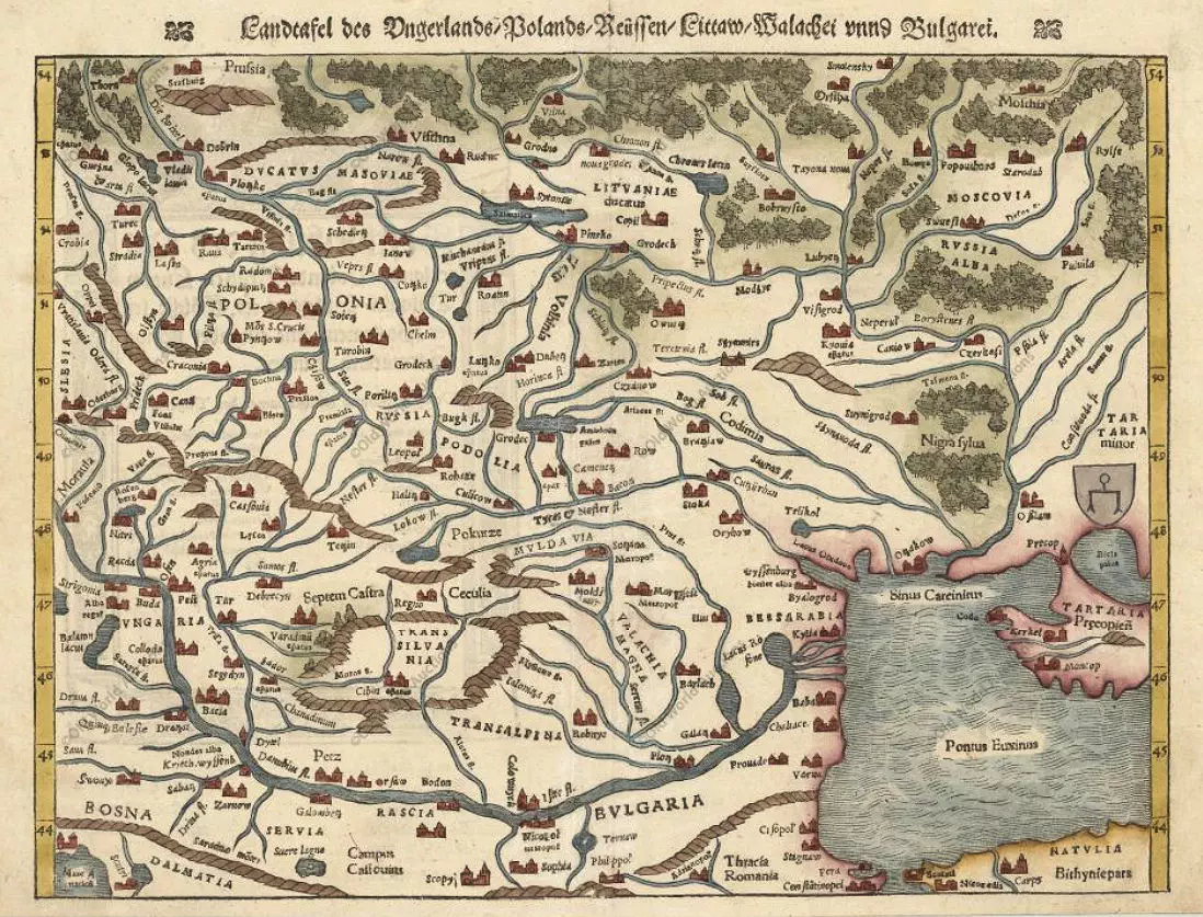
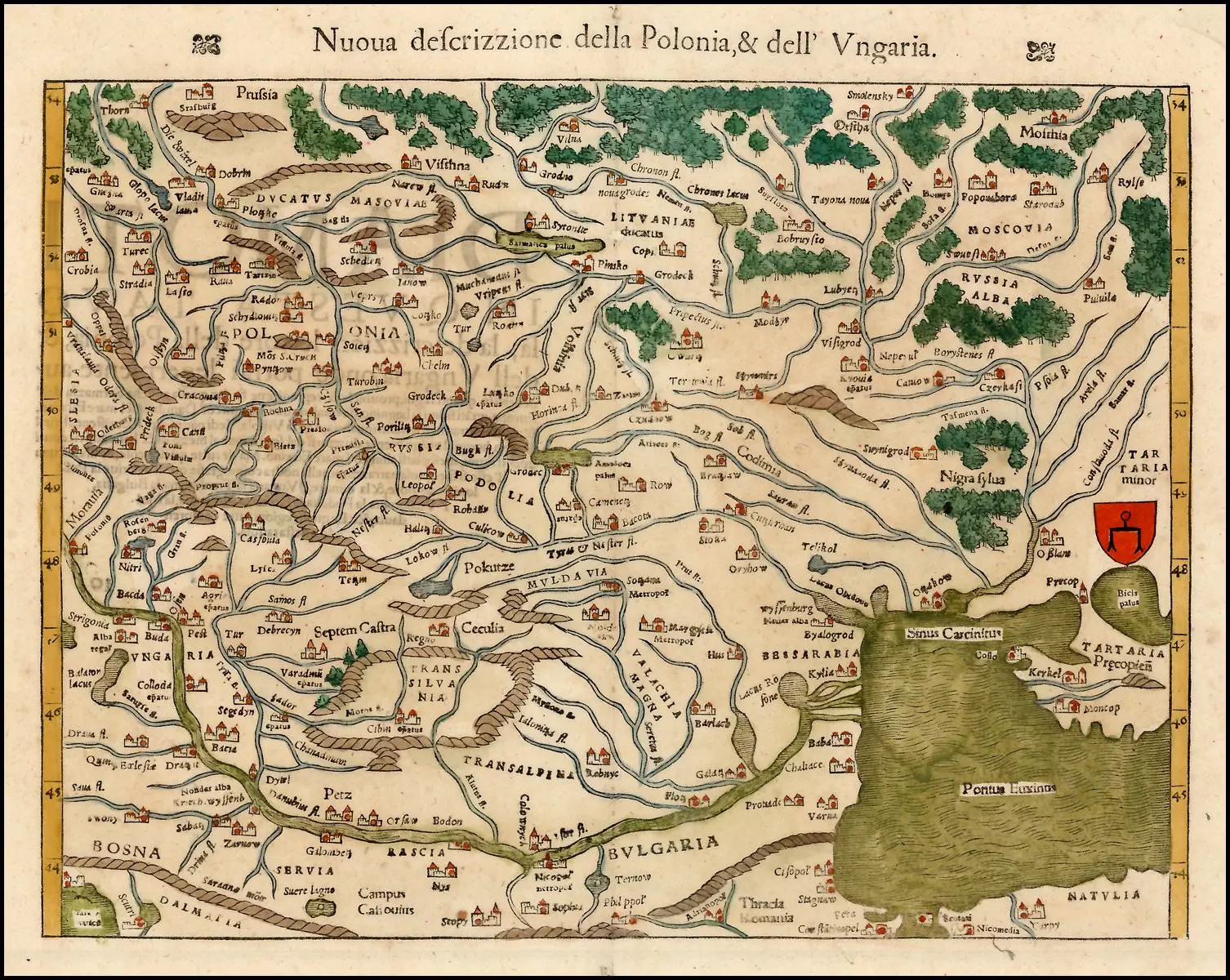
1540-1560 Sebastian Münster: “Poland and Hungary,” all from the same plate, 14 x 10 inches, as published in his Ptolemy-based “Geographia Universalis,” published from 1540 until 1628 in about 40 different editions. Only the 1545 and the 1552 editions have XX in the title above the map — other editions have XV in the title. And all the 1552 editions have coordinate bars provided at top and bottom. The map was based on ones from Bernard Wapowski, historian and “Founder of Polish Cartography,” and by Georg von Reicherstorffer, Transylvanian historian and cartographer.


![Tab[ula] mod[erna] Tartarie, (www.sothebys.com)](https://lietuvoskartografi4c16a.zapwp.com/q:i/r:0/wp:1/w:1/u:https://lietuvoskartografija.lt/lithuanianmaps/wp-content/uploads/2021/11/1524_c_fries_tab_mod_tartarie_sothebys-1024x733.jpg)