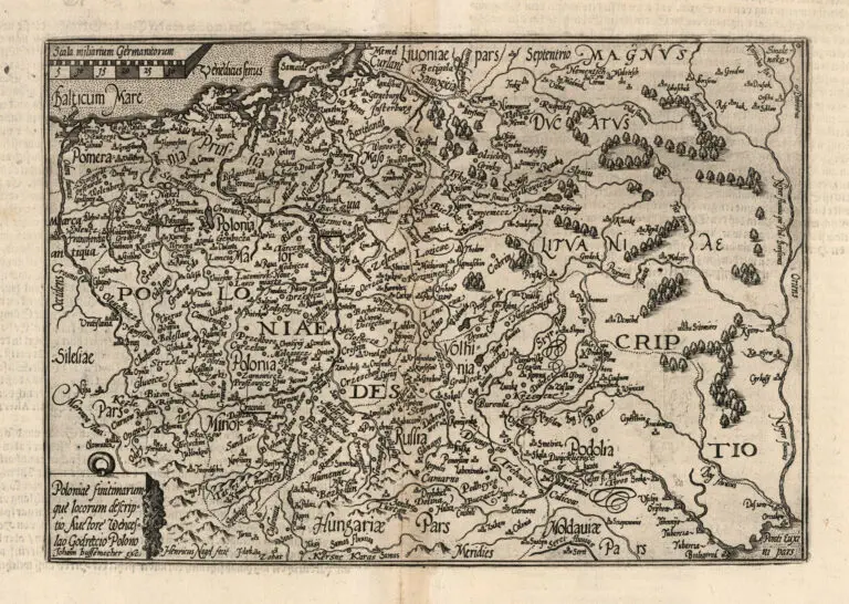
description
POLONIÆ FINITMARUMQUE LOCORUM DESCRIPTIO...
1600 Vaclovas Grodeckis (original mapmaker) – Johannes Bussemacher (engraver/printer of Ortelius’ redo) – Abraham Ortelius (revising mapmaker) – Matthias Quad (publisher): “Poloniæ finitmarumque locorum descriptio…”.
Cologne, 18 x 27 cm.
Quad was a pocket atlas publisher whose editions were cheaper alternatives to the larger folio atlases of Ortelius, Mercator, and De Jode – whose maps were the sources for Quad’s atlas maps. This map is from Quad’s second pocket atlas: “Geographisch Handtbuch” the first atlas originally written with German text, with 82 maps. His first pocket atlas, 1592’s “Europae…Descriptio”, had 38 maps, expanded in 1594 to 50 maps. His third and last pocket atlas, with 86 maps, was 1608’s “Fasciculus Geographicus”.


![Tab[ula] mod[erna] Tartarie, (www.sothebys.com)](https://lietuvoskartografi4c16a.zapwp.com/q:i/r:0/wp:1/w:1/u:https://lietuvoskartografija.lt/lithuanianmaps/wp-content/uploads/2021/11/1524_c_fries_tab_mod_tartarie_sothebys-1024x733.jpg)