Mapmakers


Mapmakers of the Historic Lithuanian Area

These records have brief summaries of the principal mapmakers— cartographers, engravers and publishers — whose works are illustrated at this site. The first mention of a relevant mapmaker on the map illustration pages is linked to the appropriate page in this section. (Information is based on a number of sources, including Wikipedia and “Tooley’s Dictionary of Mapmakers,” Revised Edition, available from www.philaprint.com).

Categories
Geographer

“Der Geograf,” 1668-69,
by Jan Vermeer. Stadel ArtMuseum, Frankfurt am Main

What do I mean by the “Historic Lithuanian Area,” which a Pole might describe as “Historic Poland,” and which a Belarussian might claim as “Historic Belarus”?


History — including cartographic history — is a function of the historian, influenced by nationalism. As a Lithuanian, I tend to consider the boundaries of the Grand Duchy of Lithuania (check out the map on the landing page) “Historic Lithuania.” Polish  commentators (and most cartographic sources) tend to describe any place within the boundaries of the Polish-Lithuanian  Commonwealth as “Poland.” To make clear the issues, consider this Wikipedia entry for a notable claimed as a “native son” simultaneously by Poland, Lithuania and Belarus:


“Born in Mereczowszczyzna, near Kosava (then in the Grand Duchy of Lithuania, which was a part of the Polish-Lithuanian Commonwealth) a town in today’s Belarus… Andrzej Tadeusz Bonawentura Kościuszko: February 4, 1746 – October 15, 1817, was a Polish–Lithuanian general and military leader during the Kościuszko Uprising. He is a national hero in Poland, Lithuania, the United States and Belarus. He led the 1794 Kościuszko Uprising against Imperial Russia and the Kingdom of Prussia as Supreme Commander of the Polish National Armed Force (Najwyższy Naczelnik Siły Zbrojnej Narodowej). Before commanding the 1794 Uprising, he fought in the American Revolutionary War as a colonel in the Continental Army. In 1783, in recognition of his dedicated service, he was brevetted by the Continental Congress to the rank of brigadier general and became a naturalized citizen of the United States. There are several Anglicized spellings of Kościuszko’s name. Perhaps the most frequently-occurring is Thaddeus Kosciusko, though the full “Andrew Thaddeus Bonaventure Kosciusko” is also seen. In Lithuanian, Kościuszko’s name is rendered as Tadas Kosciuška or Tadeušas Kosciuška. In Belarusian it is Tadevush Kastsyushka or Tadevuš Kaściuška.”

I wouldn’t have brought up the issue if I didn’t have an “Ace” up my sleeve: Forget commentators – what did Tadas himself think he was? Luckily, we have his own words, in his wills. His second, 1806, will was quoted in “The Massachusetts Law Society Journal,” Vol. XX, December, 1949 (as quoted in “Adjudication of General Kosciuszko’s Wills,” by Anthony O. Shallna, itself
quoted in a letter to the editor in the Jan/Feb 2011 issue of “Lithuanian Heritage”).


“Know all men by these presents that I, Thade Kosciuszko, formerly an officer of the United States of America in their Revolutionary War against Great Britain, and a native of Lithuania…do hereby will and direct that at my decease…”


So, at this site, Tadas is Lithuanian, as is the area the maps on this site depict — regardless of how the maps themselves are titled
and described elsewhere.

Allegory of the 1st partition of Poland


Allegory: the First Partition of the Polish-Lithuanian Commonwealth, 1772


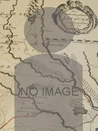
The Polish-Lithuanian Commonwealth: 1569 – 1795
The Polish-Lithuanian Commonwealth was an extension of a Polish-Lithuanian union that had existed since 1386. In theory, the two countries of the Commonwealth were equal, but Lithuania wound up having a secondary role — to the point that most references today refer to the nation as “Poland.” The Commonwealth, at 400,000 square miles and a population of 11 million, covered not only the present-day lands of Poland and Lithuania, but all of present-day Belarus, a large part of today’s Ukraine and Latvia, some of western Russia — and, at times, areas in East Prussia, Kurland and Estonia as vassal – or tributory – states. The Commonwealth lasted for more than 200 years, disappearing with the final Partitions of 1795 by Russia, Prussia and Austria. In Poland, the official languages were Polish and Latin. In Lithuania, the official languages were Old Belarusian, Latin, and Lithuanian.

From “Lithuanian historical maps: periods, methods, accuracy and perspectives” 

“The first geographical data about the territory of Lithuania are found in the works of Ancient Greeks and Romans. In the third book of the “Geographical Guide” by Claudius Ptolemy (Fig. 2 below) there is a description of the Baltic area. Unfortunately, the original map has not survived until recent time. At the present we know several maps of Central Europe compiled according to the data given by Ptolemy. In the Middle Ages these sparse and inaccurate data of the Antique geography about Lithuanian territory were almost lost. Only some maps of that time, such as Al–Idrissi of the Hereford maps, do represent the main rivers of Lithuania. In the magnificent map of Fra Mauro (15th century) the name of Lithuania has been mentioned. The first and more detailed cartographic view of Lithuania since the Antique times, appeared in the second half of the 15th century, in the epoch of the Renaissance and geographical discoveries.”


Who are the founding map-makers of the historic Lithuanian area? According to an essay at The Polish Museum:

“The catalogue is preceded by a short essay on some outstanding cartographers’ works, including maps of Poland belonging to the collection of Rapperswil. Some celebrities of cartography are mentioned due to their input in the development of the presentation of the part of Europe in question: they include Ptolemy, Wapowski, Grodecki and Wilhelm le Vasseur de Beauplan. On the other hand, there is no mention on such luminaries as Ortelius, Mercator, Blaeu or Sanson, as they had no influence on the development of cartography of the area in question, although their works included maps of Poland, Lithuania, Ukraine, Silesia and Livonia. “